
 For several weeks I continued to attempt loop rides around the basic Ft. Snelling-Mendota-Lillydale-Crosby-Hidden Falls configuration. Fort Snelling State Park was soon underwater, with access to Pike Island only available to the brave or foolhardy. Lilydale Road was subsumed with water starting at the railroad viaduct. Hidden Falls was out of the question, with water over the trail and park, all the way back to the bluff in spots. As the waters rose (on the Mississippi, but even more so on the Minnesota River) biking in any of my usual bottomland spots was ruled out more definitively than ever. The whole of Crosby Farm park was underwater, as was the entire riverbank stretch of Lilydale Road. Even the crossing from the trail, coming down off of the bluff and trying to access the trail on the other side of the road that spins you up to the I-35E bridge trail was inundated; USGS folks were using this area as a boat put-in.


It made for fun adventures, even though so many areas were off limits. It forced me onto the high paths where there were great vantage points to survey the impact of the river surges: up at the Fort Snelling overlook;, from the bike lane of the Mendota Bridge; at one point from atop the railroad viaduct and elevated rail tracks at Lilydale; from the I-35E bridge; from Shepard Road above Crosby Farm, and from a designated overlook above Pike Island in Saint Paul, where Shepard Road meets highway 5.
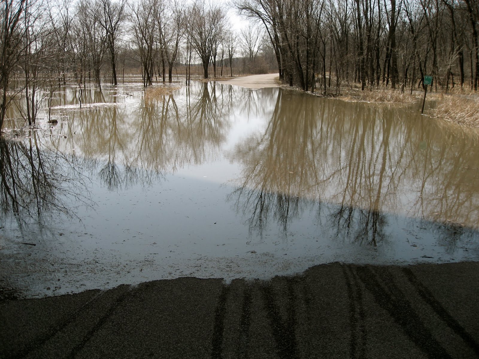

From these high vantage points I accumulated a nearly 360º view of the river valley. I witnessed, over time, the trails, roads, and parking areas of Fort Snelling State Park overtaken by the Minnesota River. I saw Picnic Island, where we had indeed stopped to picnic during our paddling adventure last fall, disappear. Pike Island, longer and larger, was like a sinking ship; I watched the front tip down and go under. Hidden Falls park was beyond hidden -- it seemed to be non-existent. The river access road flanking the I-35E bridge had become a river in its own right. I never thought I'd see the river take the whole of Crosby Farm, but it did; the two lakes there became part of the river as the waters pushed all the way back to the bluff.


Eventually the waters receded and I was able to resume some of my regular rounds. I was lucky enough to ride the full Lilydale route on the first day that it was opened to traffic; there were a couple of muddy spots and some puddles but nothing to trouble a reasonably intrepid biker. It was exhilarating to bike the section along the riverbank, as the water was still right up to the edge of the road; it was almost like biking along the surface of the river itself. Also captivating was the discovery of new wetlands and wet micro-environments along the way. I found it quite satisfying to at last complete that longer Lilydale loop, although Crosby was still out of the equation on the return. The big surprise there was the loud chorus of Hyla Crucifer (Spring Peepers) ringing out from the Mississippi bottomlands.

No comments:
Post a Comment